Two days on the sea last week made interesting plots showing we get to see much more than the tourist trips out from St. Abbs and Seahouses.
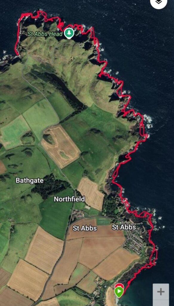
The St. Abbs trip the plot shows just how many rock formations we navigated there and back. Plenty of maneuvering practice and what sea kayakers call ‘rock hopping’. Explained simply it is trying to get over and between rocks when the swell is up, and avoiding getting marooned on rocks when the swell is down. The sightseeing tourists boats have to stay much further offshore.
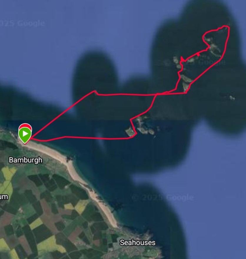
On the Farne Islands trip a significant distance was covered. Thanks to Dave’s tide and route planning for the day, we were averaging 4mph when paddling. It was a fairly calm day, but the notorious tidal flows between the islands create their own waves. The small ‘knots’ in the plotted routes path, show us playing in these tidal flows, similar to how river and white water kayakers play in the river flows and eddies.